


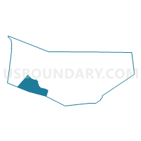
Voting District 030003, Montgomery County, New York
About
Outline

Summary
| Unique Area Identifier | 630496 |
| Name | Voting District 030003 |
| County | Montgomery County |
| State | New York |
| Area (square miles) | 21.20 |
| Land Area (square miles) | 21.12 |
| Water Area (square miles) | 0.08 |
| % of Land Area | 99.62 |
| % of Water Area | 0.38 |
| Latitude of the Internal Point | 42.84859520 |
| Longtitude of the Internal Point | -74.63351250 |
Maps

Graphs
Select a template below for downloading or customizing gragh for Voting District 030003, Montgomery County, New York


Neighbors
Neighoring Voting District (by Name) Neighboring Voting District on the Map
- Voting District 030001, Montgomery County, NY
- Voting District 030001, Otsego County, NY
- Voting District 030002, Otsego County, NY
- Voting District 030002, Montgomery County, NY
- Voting District 070001, Montgomery County, NY
- Voting District 100001, Montgomery County, NY
- Voting District 140001, Schoharie County, NY
Top 10 Neighboring County Subdivision (by Population) Neighboring County Subdivision on the Map
- Minden town, Montgomery County, NY (4,297)
- Canajoharie town, Montgomery County, NY (3,730)
- Sharon town, Schoharie County, NY (1,846)
- Root town, Montgomery County, NY (1,715)
- Cherry Valley town, Otsego County, NY (1,223)
Top 10 Neighboring Place (by Population) Neighboring Place on the Map
Top 10 Neighboring Unified School District (by Population) Neighboring Unified School District on the Map
- Canajoharie Central School District, NY (6,320)
- Fort Plain Central School District, NY (5,592)
- Cherry Valley-Springfield Central School District, NY (3,958)
- Sharon Springs Central School District, NY (2,103)
Top 10 Neighboring State Legislative District Lower Chamber (by Population) Neighboring State Legislative District Lower Chamber on the Map
- Assembly District 105, NY (137,005)
- Assembly District 127, NY (129,764)
- Assembly District 117, NY (128,680)
Top 10 Neighboring State Legislative District Upper Chamber (by Population) Neighboring State Legislative District Upper Chamber on the Map
Top 10 Neighboring 111th Congressional District (by Population) Neighboring 111th Congressional District on the Map
- Congressional District 20, NY (683,198)
- Congressional District 21, NY (679,193)
- Congressional District 24, NY (657,222)
Top 10 Neighboring Census Tract (by Population) Neighboring Census Tract on the Map
- Census Tract 7404, Schoharie County, NY (5,557)
- Census Tract 5901, Otsego County, NY (4,695)
- Census Tract 725, Montgomery County, NY (4,297)
- Census Tract 727, Montgomery County, NY (4,222)
- Census Tract 726, Montgomery County, NY (3,730)